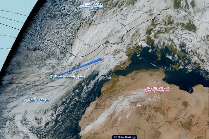
Heavy rainfall has been observed just off Morocco’s Atlantic coast, yet inland regions continue to endure dry conditions. The phenomenon, described by experts as “puzzling,” has raised questions about why rain clouds remain offshore while neighboring European countries experience significant precipitation.
According to Morocco’s Directorate General of Meteorology, the unusual weather pattern can be explained by the influence of the African High, a system of hot, dry air that prevents rain-bearing systems from the Atlantic Ocean from moving inland.
“The African High acts as a barrier, stabilizing the atmosphere and blocking low-pressure systems,” a spokesperson for the agency said.
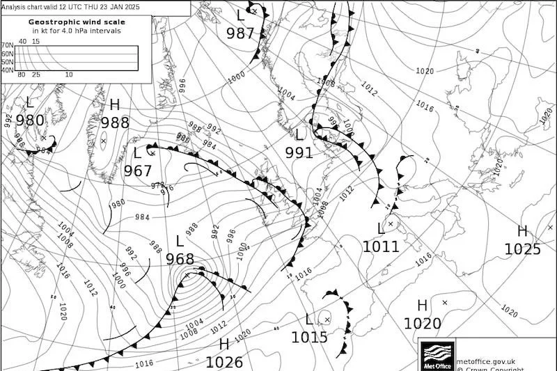
Other contributing factors include the Azores High, which reinforces atmospheric stability, and a weak subtropical jet stream that fails to guide cold, moist air toward Morocco.
Global climate phenomena, such as El Niño, and the North Atlantic Oscillation—a pressure difference between the Azores and Iceland—also play roles in shaping the region’s weather, according to meteorological experts.
Mohammed Said Karrouk, a professor of climate science at Hassan II University in Casablanca, described the phenomenon as a “disruption in atmospheric mechanisms.”
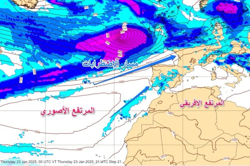
“The Atlantic Ocean is unusually warm this year, which provides additional energy to atmospheric systems. However, irregularities in the polar jet stream have caused it to redirect rain clouds toward northern Europe instead of Morocco,” he explained.
Karrouk added that the stability of the Saharan High pressure system is prolonging the drought over Morocco’s inland regions. However, he predicted that rainfall could return as soon as the system weakens.
For now, the wait for rain across much of Morocco’s mainland continues, while the Atlantic waters just off the coast remain saturated with precipitation.








add your comment
Terms of publication : Not to offend the writer, people, sacred things, or attack religions or the divine self, and refrain from racist incitement and insults.