
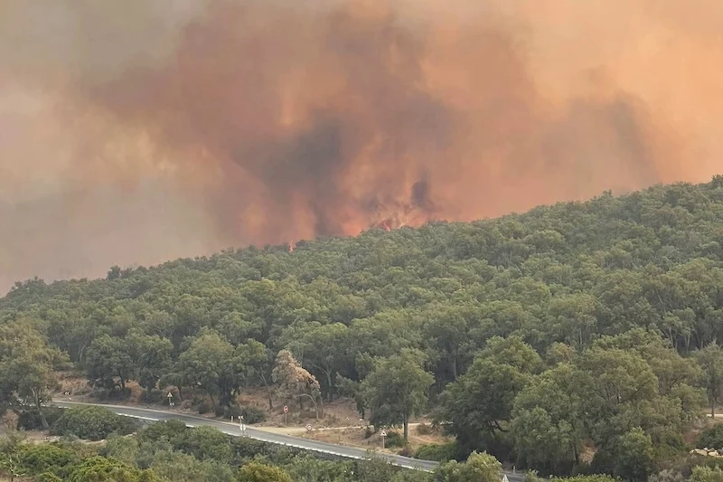
A forest fire broke out Saturday morning in the “Kedia Zekalet” woodland area located between the coastal cities of M’diq and Fnideq, according to Fouad El Assali, head of the National Center for Climate Risk Management at the National Agency for Water and Forests.
El Assali confirmed that the blaze was still in its early stages and that emergency teams launched ground and aerial operations immediately after the flames were detected.
Firefighting efforts are currently being led by a coordinated deployment of ground crews and aircraft. Four Canadair water-bomber planes from the Royal Armed Forces and four Turbo Thrush planes operated by the Royal Gendarmerie are involved.
Additional support is being provided by the Civil Protection, Royal Gendarmerie, Auxiliary Forces, and specialized forest agency teams.
El Assali highlighted that the situation remains challenging due to adverse weather conditions, including high temperatures and strong winds, which complicate efforts to bring the fire under control.
Meanwhile, local sources and social media users have linked the blaze to what they describe as an ongoing “aggressive campaign” against forested land in the region.
Allegations point to the involvement of real estate mafias and land-grabbing lobbies aiming to seize public forest areas under suspicious circumstances, often shielded by anonymous complaints and legal loopholes.
These suspicions have reignited public calls for a thorough investigation into the fire’s cause. Activists and local figures argue that similar incidents in northern Morocco have sometimes served as pretexts for illegal land use conversions.
They are demanding stronger judicial and administrative action to prevent forests from being repurposed for unauthorized private exploitation.
Earlier this week, the National Agency for Water and Forests announced the development of predictive mapping tools between July 15 and 18 to assess forest fire risks based on vegetation types, climate forecasts, and topography.
Provinces such as M’diq-Fnideq, Chefchaouen, Taounate, and Taza were flagged as high-risk zones.
Nationally, official data shows that 111 forest fires were recorded between January and June 20 of this year, below the ten-year average of 130 fires annually.
These fires have affected around 130 hectares of forest land, marking a significant decline from previous years and indicating a relative improvement in wildfire management across the country.





add your comment
Terms of publication : Not to offend the writer, people, sacred things, or attack religions or the divine self, and refrain from racist incitement and insults.