
In the aftermath of the powerful 6.8 magnitude earthquake that rocked Morocco on September 8th, satellite data has emerged as a vital tool in comprehending the extensive damage inflicted by this seismic event.
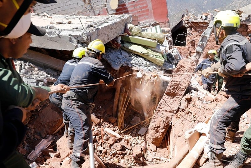
The images released, both before and after, vividly portray the extensive destruction caused by the earthquake, with buildings reduced to rubble and villages appearing desolate.

Located in the Atlas Mountains, approximately 75 kilometers from Marrakech, this earthquake was a rare and devastating occurrence for Morocco.
The International Federation of Red Cross and Red Crescent Societies, in collaboration with the United Nations Institute for Training and Research, swiftly activated the International Charter ‘Space & Major Disasters’ in response to this tragedy.
This initiative harnesses Earth observation assets from various space agencies to provide quick access to satellite images of disaster-stricken areas.
These images play a crucial role in defining the scope of the disaster, aiding rescue teams on the ground, and supporting the planning of recovery efforts.
Among the crucial satellites contributing to this effort is Europe’s Copernicus Sentinel-1 satellite mission. Armed with radar instruments capable of sensing the ground and penetrating through clouds, day or night, this technology has proven paramount in assessing the earthquake’s aftermath.
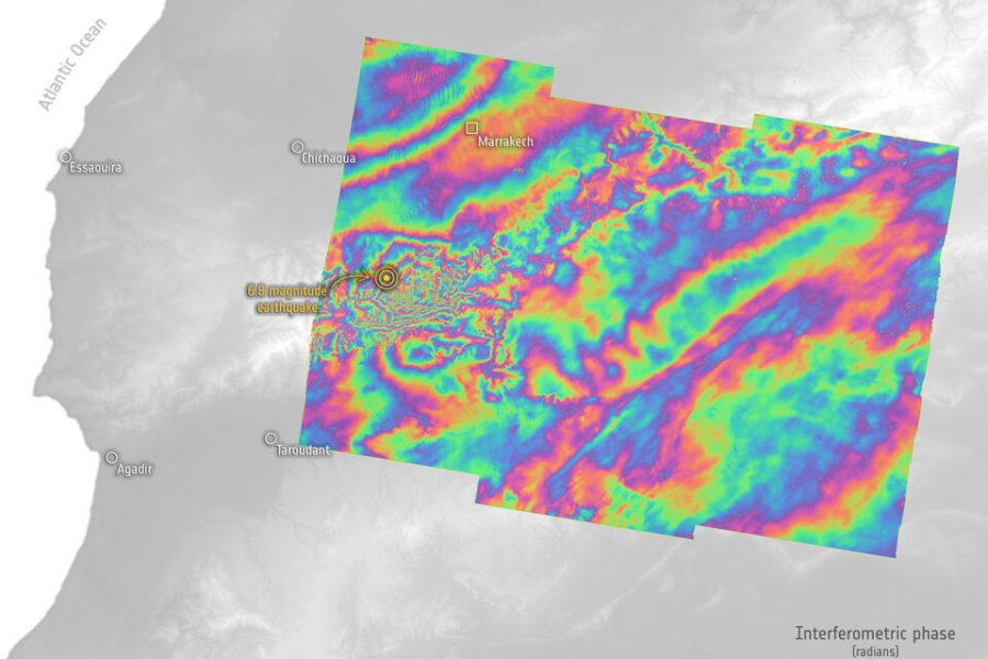
By measuring changes in the Earth’s surface caused by the quake, Sentinel-1 has enabled scientists to create interferograms, a detailed visual representation of the earthquake’s impact.
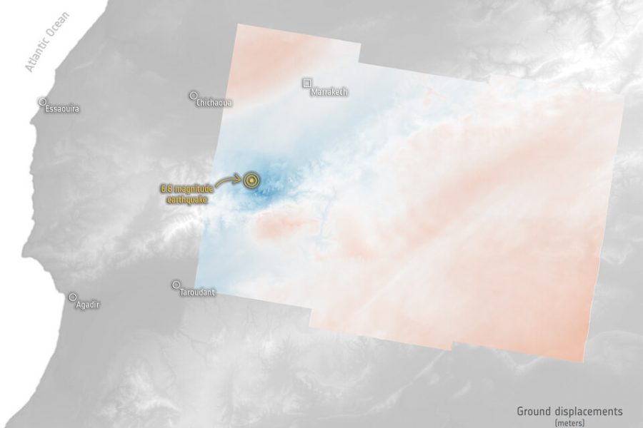
Interferometry involves comparing radar images captured before and after the earthquake. The result is a vivid and informative interferogram, which reveals intricate patterns of ground displacement.
The satellite data and interferograms generated from Copernicus Sentinel-1 have not only offered crucial insights into the extent of the damage but have also proven instrumental in guiding rescue and relief efforts on the ground.
These detailed maps have allowed rescuers to make informed decisions, such as identifying safe routes and avoiding unstable infrastructure.
As the response to Morocco’s earthquake continues, scientists are using the wealth of data from the Copernicus Sentinel-1 mission to deepen their understanding of seismic events and their long-term impacts. This information will not only assist in immediate recovery efforts but will also contribute to planning for future disaster resilience and preparedness.





add your comment
Terms of publication : Not to offend the writer, people, sacred things, or attack religions or the divine self, and refrain from racist incitement and insults.