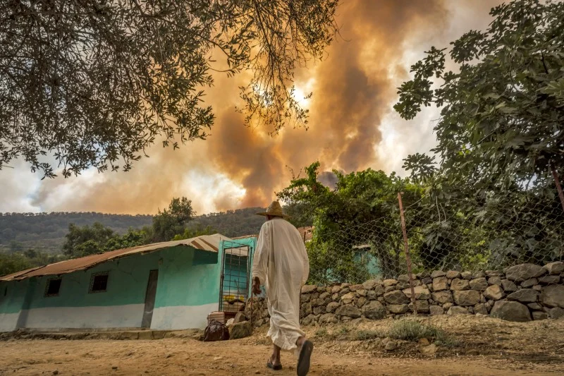
Amidst scorching heat waves reaching temperatures between 44 and 48 degrees, sweeping through numerous regions in Morocco, the Meteorological Directorate has issued repeated warnings about the escalating risk of forest fires.
The latest updates, confirming a red alert level, have raised concerns as several Moroccan cities find themselves on high alert.
The cities in question are Ouazzane, Guercif, Taourirt, Oujda Angad, Taounate, Moulay Yacoub, Sefrou, Fez, Meknes, Taza, Khemisset, Sidi Kassem, Sidi Slimane, Beni Mellal, Fakih Ben Salah, Khouribga, Settat, Marrakech, Kalaat Sraghna, Rhamna-Zagora, Tata, Taroudant and Assa Zag.
The National Agency for Water and Forests’ most recent daily map updates, which use scientific data to predict the phenomenon of forest fires at the national level, indicated the alarming expectations for this Monday and Tuesday.
The regions of Agadir Adaoutan, Beni Mellal, Khenifra, and Taza are at the top of the areas most threatened by fires, according to the “Forest Fire Risk Bulletin,” which Hespress AR was able to obtain a copy of.
These areas are now classified as a “red level with extreme danger.”
The same data indicated that each of the forests in the provinces of Taroudant, Essaouira, Berkane, Driouch, Ouejda Angas, Azilal, Ifrane, Sefrou, Taounate, Chefchaouen, Larache, Tangiers, Asilah Ouazzane, and Guercif are at a high risk of starting a fire, with an orange degree of danger.
The provinces of M’diq, Fnideq, Kenitra, Sidi Slimane, Nador, Rabat, Sale, Skhirat-Temara, Al-Hoceima, Fahs-Anjra, Tetouan, and Sidi Slimane were rated as having a medium risk with a yellow color.
The organization advised residents and workers who live close to forested areas to be cautious, as well as tourists, emphasizing that they should refrain from engaging in any activity that could start a fire and should notify local authorities right away if they notice any smoke or other unusual activity.
Since the start of the summer, the National Agency for Water and Forests has started releasing special bulletins every day that are based on scientific information.
These bulletins include “forecast maps” that precisely identify vulnerable areas at risk of forest fires and information about the levels of danger in each region based on specific criteria.







add your comment
Terms of publication : Not to offend the writer, people, sacred things, or attack religions or the divine self, and refrain from racist incitement and insults.